The Development of Groundwater Monitoring Systems in Strategic Aquifers in Southern Africa
The Southern African Development Community (SADC) hosts as many as 32 transboundary aquifers (TBAs) among its member states. These aquifers are strategic regional and national resources crucial to groundwater supply and to improving livelihoods within the member countries. There are numerous challenges to sustainable resource management and the utilization of these aquifers, including limited understanding of the aquifers due to inadequate groundwater monitoring and a lack of groundwater data within the respective Member States. To improve understanding of aquifer sustainability and promote effective resource management and utilization, it was critical to develop strategic groundwater monitoring systems within selected aquifer typologies. This project was commissioned to identify three (3) aquifers, each representative of one of three typologies, to be used as “pilot” project areas for developing groundwater monitoring systems. The monitoring systems, once established, would be used to assess success and any challenges encountered, and to draw lessons to improve future groundwater monitoring data collection and to enhance the understanding and management of similar aquifers in other southern African states. It was envisioned that improved groundwater monitoring data collection would also strengthen institutional arrangements through data sharing, supported by data-sharing protocols.
The project had three main objectives:
- Identification and selection of three strategic Aquifers across the SADC Region along three respective typologies:
- Fractured or Karst TBA on mainland SADC
- Coastal Aquifer
- Island State Aquifer
- Development of a groundwater monitoring plan for each respective selected strategic aquifer
- Preparation of procurement documents and bill of quantities for works, goods, and services for the installation of a monitoring system using telemetry in each of the representative three (3) typology aquifers
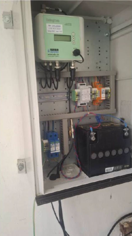
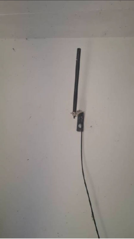
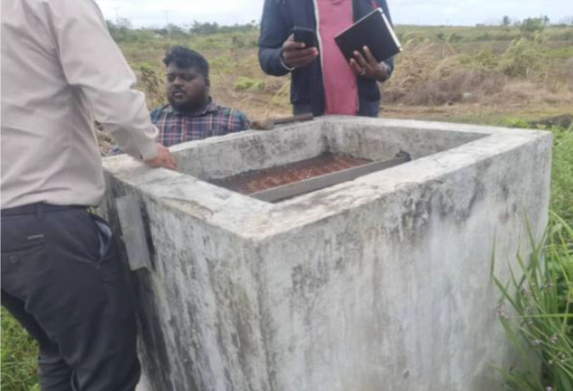
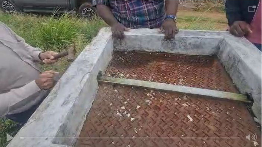
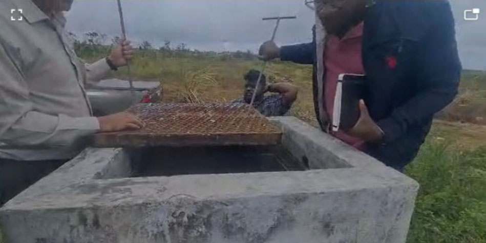
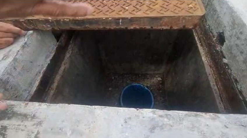
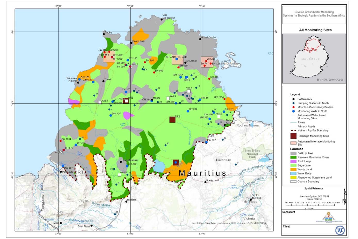
The Northern Aquifer V occurs in northern Mauritius and covers the relatively flat, gently sloping volcanic basaltic plains that slope westward, northward, northeastward, and eastward toward the coastline. The geology of Mauritius is characterized by three major volcanic episodes, which occurred after the primary formation and stabilization of the island’s base. The volcanic episodes resulted in basaltic breccias. The high groundwater potential is attributed to the recent scoriaceous or vesicular and tunneled basalts and the intermediate-series basalts, owing to their high porosity and permeability. The ancient basalts form the impermeable rocks that mark the southern boundary of Aquifer V and have low groundwater potential due to the lack of primary porosity and permeability. Groundwater accounts for more than 50% of Mauritius’s water supply. The estimated total annual groundwater abstraction in Mauritius is approximately 160 million cubic metres (Mm3). Approximately 33.5 Mm3/year is abstracted from the northern aquifer, Aquifer V. The revised groundwater network was designed to (i) evaluate the impacts of abstraction on groundwater levels; (ii) assess groundwater recharge upstream and groundwater discharge in the downstream areas demarcated based on the groundwater flow pattern; and (iii) monitor groundwater quality. The location of the monitoring sites is shown in the figure below. Terms of reference and a bill of quantities were developed for the groundwater monitoring system.
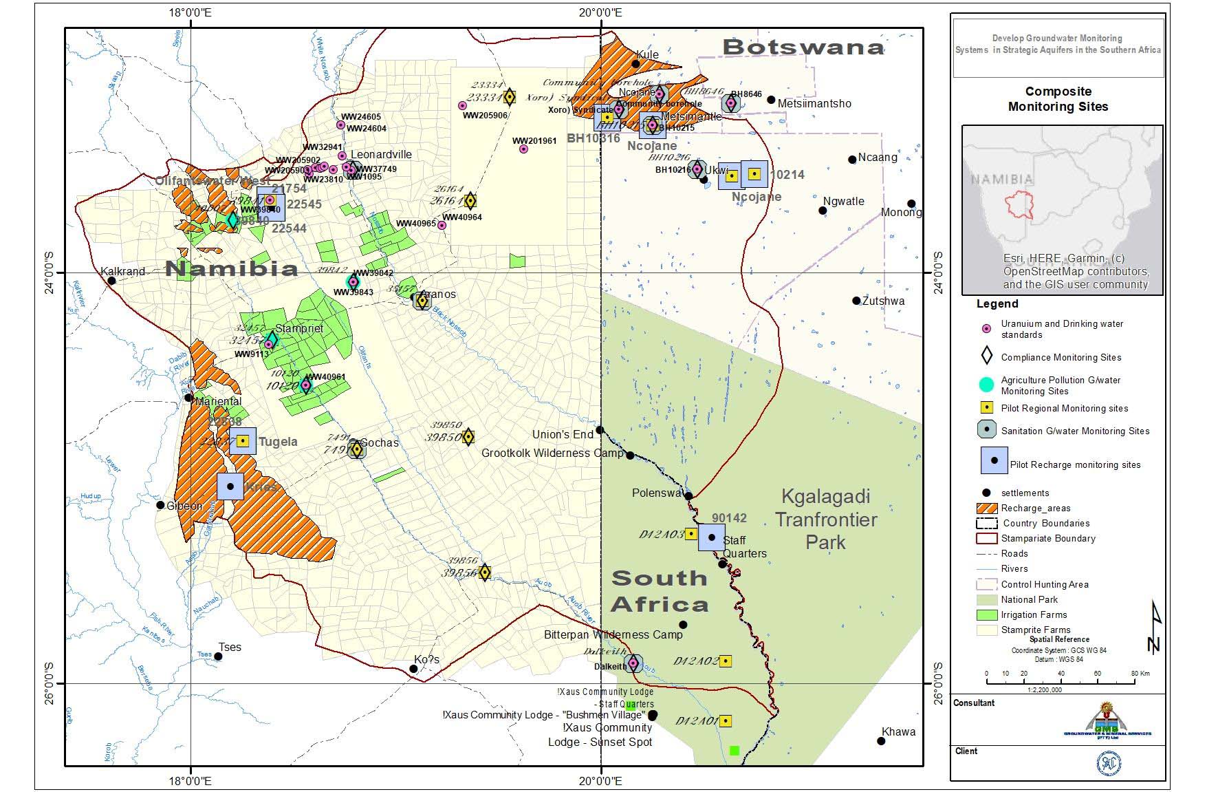
The Stampriet Basin Aquifer System (STAS) is located in central Namibia, western Botswana, and part of the Northern Cape Province of South Africa. The STAS is a fractured sedimentary aquifer with high groundwater potential within a multi-layered Lower Karoo sandstone stratigraphy and overlying unconfined Kalahari sediments, particularly in Namibia. The total maximum abstraction is approximately 14 million cubic meters per year. The revised groundwater network is designed to (i) evaluate the impacts of abstraction on groundwater levels and resources from the Kalahari, Auob (Namibia)/Otshe (Botswana), and Nossob aquifers; (ii) monitor and quantify groundwater recharge; and (iii) monitor groundwater quality. The following monitoring network was proposed for the STAS:
- 46 boreholes to be equipped with automatic data loggers for abstraction impacts and regional monitoring
- 14 boreholes will be monitored for recharge
- 18 boreholes in the Kalahari aquifer will be monitored for poor sanitation pollution
- 7 boreholes within irrigated farmland in Namibia will be monitored for agricultural pollution
- 18 boreholes will be monitored for compliance with national drinking water standards
- 27 boreholes will initially be monitored for baseline radionuclides
- 21 boreholes will be monitored for the proposed in-situ mining in the northern part of the STAS in Namibia
Following the initial sampling results, the plan was to extend the monitoring network southward. To provide basin-wide baseline monitoring data, four production boreholes and one production borehole will be monitored for radionuclides in Botswana and South Africa. The total number of sites to be monitored for the proposed transboundary monitoring objectives is 81.
A groundwater monitoring plan, including the recommended borehole design, monitored parameters, monitoring frequency, and monitoring methodology, were provided. Terms of reference and a bill of quantities for the development of the groundwater monitoring system were provided.
The Coastal Sedimentary Basin IV was chosen for the coastal aquifer. CSBIV is shared between Angola and Namibia. It was mapped only in Namibia and was postulated to continue northward into Angola. The lack of hydrogeological data across the Cunene River makes it challenging to definitively ascertain the basin’s transboundary nature. However, subsequent findings indicate a possible, though limited, connection between the basin mapped in Angola and the existing one in Namibia. The basin mapped in Angola is likely to be very shallow, with subcropping to outcropping basement rocks, hence spatially limited in extent and depth. A larger basin, however, not connected to CSBIV, was mapped in the east around the Otumba-Espinheira area. Although thick sediments were inferred in Namibia, part of the basin, without borehole data, it cannot be confirmed whether these are dunes or whether a saturated aquifer exists. A monitoring network design was not pursued for the aquifer system.
The project was completed in February 2024.