INMACOM Hydrocensus
SADC-GMI supported a hydrocensus in the Incomati and Maputo Basins. The total project area of the combined Maputo and Incomati Basins is 77,000 km2, with both catchments covering parts of South Africa, Eswatini, and Mozambique. The most significant part of the basins is underlain by the Precambrian Basement, which is generally low in potential for groundwater development and has discontinuous, low-yielding aquifers, primarily associated with deep-weathering and fracturing zones. Along the border of Mozambique, South Africa, and Eswatini are the Lebombo volcanics of the Karoo Supergroup. These formations are marked by low primary permeability but have moderate productivity within major faults and along lithological contacts. The unconsolidated intergranular aquifers along the coast of Mozambique generally have a high potential for groundwater development and are the most productive. The scope of the assignment included collecting information on groundwater resources and existing boreholes in the INMACOM area.
An analysis was performed on the selected borehole sites from the SADC GMI (2010) country databases within the hydrocensus sample quadrants. The 846 borehole chosen sites from the country databases represent 1221 borehole records: 705 in the Incomati Basin and 516 in the Maputo Basin. No active monitoring of operational boreholes was observed in any of the 3 INMACOM countries, by either public institutions or private owners. None of the 26 motorized boreholes visited during the hydrocensus survey was fitted with a functional water meter or dipper line. Furthermore, none of the 52 active DWS-IUCMA monitoring boreholes were used for groundwater abstraction. As a result, DWS-IUCMA was not conducting abstraction monitoring, and little was known about aquifer status and groundwater volumes withdrawn by pumping. Where monitoring practices were in place, only water levels, EC/TDS, and a few other hydrochemical parameters were routinely measured; most macro- and trace constituents were not measured.
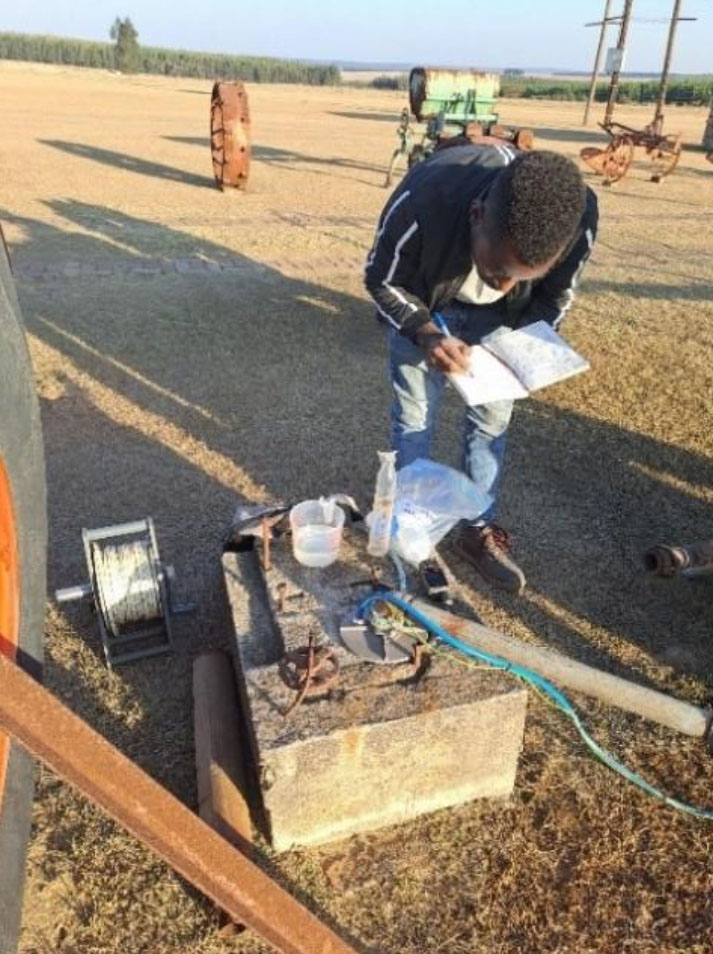
Field parameters measured included EC, TDS, pH, and Temperature, as well as qualitative parameters (color, odor, taste, and general appearance). In the Incomati Basin, most upper- and middle-catchment-area parameters were within standard limits, with a few exceptions. Samples from the lower catchment area exhibited higher mineralization, alkalinity, and hardness, as well as elevated concentrations of other parameters, with several exceeding standard limits. Whilst in the Maputo Basin, generally marked by relatively good water quality and lower mineralization, with most parameters within acceptable limits, but with a few exceptions.