


Sub Grants Project
Component 3 of the Sustainable Groundwater Management in SADC Member States project Phase 2 speaks to Building Resilient Livelihoods and Inclusive Groundwater Management. Under this component, SADC-GMI awarded small grants to Member States to implement pilot projects that can be scaled up in the future. To date, the following Member States have submitted concept notes and proposals for project implementation. The following Member States have projects at various stages of implementation:
Countries
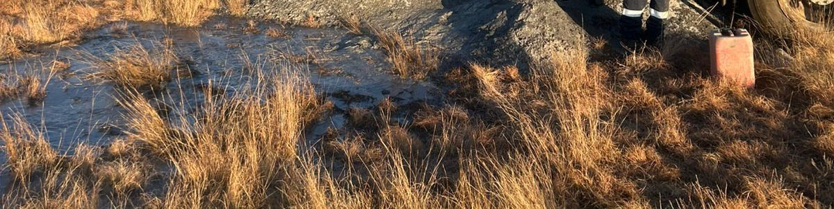
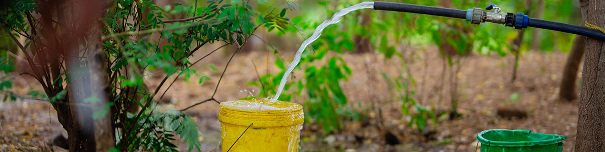
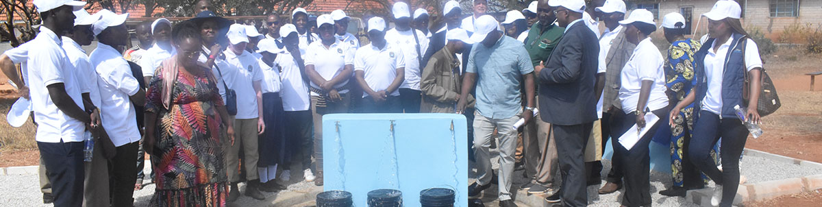
Installation of water supply systems to strengthen the water supply capacity to the communes of Caiave and Catengue of the municipality of Caimbambo
Background
The National Institute of Water Resources (INRH), under the Ministry of Energy and Water (MINEA), in collaboration with the SADC Groundwater Management Institute (SADC-GMI), is implementing the Groundwater Monitoring and Management Project in Caimbambo Municipality, Benguela Province, Angola.
Caimbambo Municipality experiences recurrent water shortages due to limited surface water availability, climate variability, and insufficient water infrastructure. The reliance on groundwater as a primary water source has increased, yet groundwater resources in the area require systematic development, monitoring, and management to ensure sustainability and resilience.
In response to these challenges, the project focuses on strengthening groundwater-based water supply systems through targeted borehole drilling and the installation of associated water infrastructure. The initiative supports improved service delivery, enhances community resilience to climate change impacts, and contributes to sustainable water resource management in line with national and regional water policies.
Project Objectives The overall objective of the project is to strengthen water supply capacity and improve access to safe and reliable water for the communes of Caiave and Catengue in the Municipality of Caimbambo, Benguela Province.
Specifically, the project aims to:
- Drill and equip two (2) boreholes based on hydrogeological and geophysical investigations;
- Install associated small-scale water supply systems, including solar-powered pumping systems and water storage facilities;
- Promote the sustainable use and management of groundwater resources; and
- Enhance water security and resilience for local communities.
Project progress
The Caimbambo Groundwater Monitoring and Management Project is progressing in line with its planned objectives. The project implementation framework has been established, and coordination between the National Institute of Water Resources (INRH), the Ministry of Energy and Water (MINEA), and SADC-GMI is ongoing.
Overall, the project is advancing steadily, with implementation activities aligned to strengthen water supply capacity and improve sustainable groundwater utilization in the target communities.
Project achievements
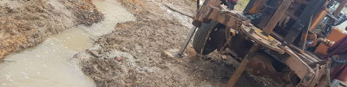
- comprehensive hydrogeological and geophysical assessment was successfully conducted, providing a sound technical basis for borehole siting and groundwater development.
- One (1) production borehole were successfully drilled, confirming the availability of viable groundwater resources.
ESMP Angola Sub Grant: Download
Implementation of a mini network of drinking water, distribution in the city of Madimba in the Province of Kongo Central
Background
Madimba, established in 1912, is one of the oldest territories in the Democratic Republic of Congo. Despite its historical significance, the city has never had a functioning drinking water distribution system. Previous attempts to establish one have repeatedly failed, largely due to the city’s challenging geological conditions, characterized by hard bedrock with minimal fracturing and limited groundwater circulation.
With funding from the SADC Groundwater Management Institute (SADC-GMI), the Directorate of Small Water Units under the General Secretariat for Water Resources and Electricity embarked on a project to establish a formal drinking water distribution system that brings safe water closer to the residents of Madimba. This funding is made available by the World Bank, supported by the Global Environment Facility (GEF) and the Cooperation in International Waters in Africa (CIWA) Trust Fund.
This project involves the construction of a mini water distribution network in the city of Madimba, located in Kongo Central Province. It forms part of the broader initiative for the sustainable management of groundwater resources within the Member States of the Southern African Development Community (SADC).
Project Objectives
The general object of the project is to ensure access to safe drinking water for the residents of Madimba. With a specific objective to install a mini-network for the distribution of drinking water within the city of Madimba.
Project progress
The project was concluded in November 2024.
Project achievement
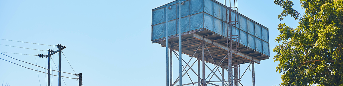
Through the project, three boreholes were drilled and successfully equipped with operational pumping systems. A water tower fitted with tanks exceeding 20 m³ was also constructed. In addition, eleven standpipes were installed closer to residential areas, significantly reducing the distance residents need to travel to access water.
ESMP documentation: Download
Supply of drinking water and improvement of the living conditions of the population in the city of Kimpangu
Background
The severe scarcity of clean water, sanitation, and hygiene facilities directly fuels preventable waterborne illnesses, causing a shocking 88% of diarrheal fatalities and 75% of all intestinal infectious diseases. This crisis disproportionately affects children under five, who tragically account for nearly half of all water-related deaths.
The community of Kimpangu in the Democratic Republic of Congo vividly exemplifies this global issue, facing extreme water scarcity and its dire repercussions. Lacking formal water supply infrastructure, its residents depend on unimproved, inadequately protected natural sources, leading to significant health hazards. /p>
This critical situation highlights the urgent necessity for the proposed project: to construct a mini water supply network in Kimpangu. This initiative is crucial for uplifting living standards, enhancing public health, and promoting sustainable community development.
Project objectives
This project aims to address fundamental human needs by ensuring access to clean water and hygienic sanitation for domestic use. It reflects a deep commitment to elevating living conditions in a community that has long struggled with access to safe water. The initiative involves a comprehensive solution: installing a mini-drinking water distribution network, building hygienic latrines, and establishing a photovoltaic power station. This integrated strategy seeks not only to fulfil basic requirements but also to promote sustainable development and enhance overall public health and well-being.
Project progress:
This project has been successfully concluded, with every planned deliverable meticulously executed. The initiative officially ended in 2025, marking a significant milestone.
Project achievements
The successful drilling and completion of a 150-meter-deep borehole marks a pivotal achievement for this initiative. This accomplishment powerfully demonstrates the necessity of employing advanced drilling techniques to tap into reliable aquifers, thereby securing a consistent and sustainable water source for the community. Such dedicated efforts underscore the crucial role of the Government of the Democratic Republic of Congo in fulfilling fundamental human needs and significantly elevating the living standards of its citizens. This project is poised to directly benefit an estimated 5,065 residents of Kimpangu, including men, women, and children, promising a profound and lasting positive transformation for the local community’s well-being and future prosperity.
ESMP documentation: Download
Improving knowledge of groundwater availability through the assessment of available groundwater resources, capacity development, and innovative groundwater information management.
Background
Groundwater is a strategic socio-economic resource essential for sustainable development in the Kingdom of Eswatini, where over 75% of the rural population depends on it for domestic and livelihood needs. Despite its importance, groundwater management faces challenges related to policy, legislation, institutional capacity, and coordination. Although the National Water Policy (2018) recognises the value of groundwater, further emphasis is needed on its sustainable management and integration into national development planning.
Weak management practices and limited awareness of groundwater’s role in supporting livelihoods, poverty reduction, and food security continue to undermine its potential. If not effectively addressed, these challenges could constrain economic growth and intensify the impacts of climate change on water and food systems.
With support from the Southern African Development Community Groundwater Management Institute (SADC-GMI), Eswatini completed a situational and gap analysis and a sustainable groundwater monitoring and management study, which this project now seeks to operationalise.
Project Objectives
The project aims to strengthen knowledge of groundwater resources to establish a sound information base for their management and development. By protecting this vital resource, the initiative contributes to resilient livelihoods and improved rural planning. It introduces innovative approaches for enhancing groundwater knowledge, building the capacity of managers and stakeholders, and developing a state-of-the-art groundwater monitoring information system.
Project Progress
The project was successfully completed in mid-2025, with all planned activities finalized in accordance with the project objectives. Furthermore, all project deliverables were comprehensively prepared, completed, and formally submitted as required.
Project Achievements
Through the implementation of this project, several key outputs were developed. A comprehensive groundwater resource map and an accompanying handbook for Eswatini were produced to support improved understanding and management of the country’s groundwater resources. In addition, the Groundwater Information System (ESMIS) was successfully established to enhance data management, accessibility, and monitoring of groundwater information. The project also resulted in the development of a detailed Groundwater Monitoring Strategy for Eswatini, aimed at strengthening long-term groundwater monitoring and sustainable resource management.
Eswatini Consolidated SEASH LMP: Download
Eswatini_ Stakeholder Engagement Plan: Download
Construction of Groundwater Monitoring And Water Supply Systems
Background
Groundwater is Lesotho’s most crucial natural resource, providing potable water for most of its population, especially in rural areas. Many rural households contend with a severe deficit in access to safe drinking water and adequate sanitation. Exacerbating this challenge, women and young girls frequently undertake arduous journeys, often exceeding 1 kilometer, to procure water. Unlike many African nations, where inherent water scarcity is the principal concern, Lesotho’s dilemma arises predominantly from a lack of expertise and infrastructure to ensure water accessibility. Furthermore, evidence indicates that numerous monitoring boreholes are now defunct. The severe El Niño event of 2015-2016 intensified this crisis, precipitating Lesotho’s most severe drought and leaving both communities and livestock acutely water-deprived. In response, this project, spearheaded by the Ministry of Natural Resources through the Department of Water Affairs, is poised to bolster groundwater monitoring and supply within these impacted communities significantly.
Project objectives
This project aims to refine groundwater monitoring and evaluation, thereby ensuring the efficient and sustainable deployment of this crucial resource for household use, agricultural needs, and ecological protection. The undertaking involves the strategic drilling of novel boreholes, intended for both surveillance and the delivery of vital water to vulnerable communities, as well as harnessing natural springs for broader provision. Core activities include precisely locating existing boreholes and natural springs, drilling new boreholes, cultivating community expertise in sustainable water management techniques, and performing necessary minor upkeep of borehole infrastructure.
Project progress
The project was successfully completed during the final quarter of 2025, marking the conclusion of all planned activities and the achievement of the intended project objectives.
Project achievements
In each of the two villages, a production borehole and a dedicated monitoring borehole have been successfully drilled. Following this, the production boreholes were fully equipped with the essential pump systems. Furthermore, the project advanced by installing sophisticated groundwater monitoring devices, specifically data-loggers, within the monitoring boreholes to ensure continuous and accurate data collection. This endeavour is set to markedly improve groundwater monitoring in regions where the infrastructure has been established. This elevated scrutiny will yield indispensable data, consequently enabling more efficient and strategic management of this essential resource. Moreover, the project will significantly increase water supply in the communities of Ha Koali and Ha Mosotho, serving both human inhabitants and livestock, thereby fostering comprehensive community resilience and prosperity.
ESMP Documentation: Download
Sustainable groundwater management through a participatory approach
Background
Lesotho’s groundwater monitoring has unfortunately weakened, leading to inadequate data gathering and negatively impacting annual evaluations of the country’s groundwater condition. This degradation arises from a mix of external and internal issues, prominently including limited access to specific groundwater observation sites, particularly in isolated areas. Thus, embracing advanced real-time groundwater monitoring techniques has become crucial. Globally, groundwater is valued as a primary source of drinking water and irrigation due to its consistent reliability. In Lesotho, it is the most essential natural resource, providing a consistent potable water supply for the majority, especially in rural communities. Tackling these urgent challenges demands the prompt development and implementation of novel strategies for sustainable groundwater management that actively involve local communities; hence, the Government of Lesotho proposed Sustainable groundwater management through a participatory approach to address pressing issues highlighted above.
Project objectives
This initiative is designed to foster sustainable groundwater management through a comprehensive dual approach. The approach emphasizes establishing a strong participatory framework within chosen communities, empowering local individuals, and incorporating vital community perspectives to cultivate authentic ownership and effective resource stewardship. Simultaneously, it advocates integrating and using the latest, most advanced technologies to ensure real-time oversight, sophisticated evaluation, and data-driven optimization. This integrated method aims to safeguard the enduring vitality, accessibility, and fair allocation of this essential resource, enhancing resilience and capability for coming generations.
Specific Objectives
- To improve monitoring on selected boreholes
- To enhance the water supply at Ha Mpusi village
- To improve safety and water security for the selected villages
Project progress
The project has advanced significantly from its initial planning phase and is presently at the mid-implementation stage, during which several critical activities have been successfully undertaken and completed. These activities include the drilling of boreholes and the finalisation of reticulation system designs, both of which represent important milestones and demonstrate substantial progress in the overall implementation of the project. These developments lay a strong foundation for the subsequent phases of the project and contribute directly to achieving its intended objectives.
The upcoming phase will primarily focus on the construction and installation of the reticulation systems, which is a crucial component in ensuring that the community of Ha Mpusi obtains reliable, safe, and sustainable access to a secure water supply. Furthermore, the project includes the planned installation and finalisation of telemetry stations to strengthen system monitoring, enhance data collection processes, and improve the overall management and operational efficiency of the water supply infrastructure.
Project achievements
The initial phases of the project involved comprehensive environmental and social impact assessments, which were carefully conducted and integrated to ensure a thorough understanding of the project’s potential effects while addressing the concerns and priorities of the local community. These assessments provided a strong foundation for responsible project implementation and ensured that environmental sustainability and social considerations were fully incorporated into the planning process.
Following this, a detailed hydrogeological survey was undertaken in close collaboration with community stakeholders to identify areas with significant groundwater potential. This process included the careful selection of suitable locations for groundwater development, precise borehole siting, and the execution of rigorous aquifer testing to determine sustainable water yields.
As a result of these efforts, both a production borehole and several monitoring boreholes were successfully drilled, marking important milestones in the project’s development. In addition, the designs for the reticulation systems have been completed, providing a clear framework for the next stage of infrastructure implementation.
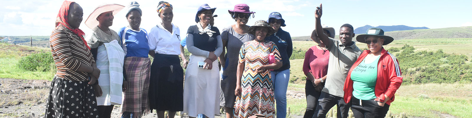
A key component of this initiative has been the strong collaboration between the Department of Rural Water Supply, the Department of Water Affairs, and the local community. This partnership has not only supported effective project execution but has also focused on building local capacity by equipping community members with the necessary skills and knowledge to manage, maintain, and sustain the water supply infrastructure, thereby ensuring its long-term functionality and reliability.
ESMP Documentation: Download
Rehabilitation of 20 existing monitoring wells
Background
Malawi’s groundwater monitoring system currently grapples with significant operational challenges. A comprehensive national assessment conducted in early 2022 by the Groundwater Division of the Ministry of Water and Sanitation, in collaboration with Baseflow, revealed a concerning statistic: 84% of data loggers nationwide were either non-operational, vandalized, or inaccessible for manual data download. Compounding this issue, numerous monitoring wells sustained substantial vandalism to their civil infrastructure, including critical components such as manhole covers and concrete surrounds. Furthermore, only a small proportion of these wells had community-based gauge readers, and most lacked adequate site management training. The critical role of these community-based readers is undermined by this lack of proper training, hindering effective site management and inadvertently contributing to infrastructure vandalism. In response to this pressing crisis, the Government of Malawi has initiated the rehabilitation of the 20 monitoring wells project, a vital step towards fostering sustainable groundwater management through robust monitoring systems.
Project objectives
To advance sustainable groundwater management, this initiative targets several key areas. It seeks to reinvigorate the current groundwater monitoring network by restoring 20 wells and strategically placing three telemetry-equipped monitoring wells in vital aquifers. Concurrently, a robust capacity-building program will be launched to educate national, district, and community stakeholders, enabling them to oversee the groundwater monitoring network effectively. Additionally, extensive community awareness efforts will be undertaken to deepen understanding of the critical role groundwater monitoring wells play in sustainable water resource management. Ultimately, improved coordination and strengthened collaboration among national, district, and local governments and communities are essential for the network’s efficient operation and ongoing maintenance.
In addition, the project incorporated rehabilitation of three production boreholes and installing the with handpumps as part of the livelihood component.
Project progress
The project’s deliverables were completed in December 2024.
Project achievements
The restoration of twenty monitoring wells and drilling of three new monitoring boreholes has markedly strengthened Malawi’s capabilities for groundwater resource monitoring and assessment. This pivotal upgrade will furnish decision-makers and planners with immediate data, fostering more effective strategic planning. Simultaneously, robust capacity-building programs have been successfully concluded with local stakeholders, empowering them to maintain the infrastructure in the long term. All these indispensable project activities have now been finalized, following the project’s successful conclusion.
ESMP Documentation: Download
Piloting the managed aquifer recharge in selected hydrogeologically difficult areas of the Central Region of Malawi
Piloting the Managed Aquifer Recharge (MAR) in selected hydro-geologically difficult areas of the Central Region of Malawi
Background
Groundwater is the main source of water supply for rural communities in Malawi, primarily accessed through hand-pump boreholes and, in some towns, motorised boreholes connected to piped water supply systems. When properly managed, groundwater provides a reliable and resilient water source. However, increasing climate variability and change have negatively affected aquifer systems in many parts of the country, resulting in declining groundwater levels and reduced borehole yields.
Hydrogeological and geophysical investigations indicate that several aquifers in Malawi have limited recharge and weak hydraulic connectivity to rainfall. Consequently, many boreholes that initially show promising yields become seasonal, producing adequate water during the rainy season but experiencing significantly reduced yields or complete failure during the dry season. This seasonal variability compromises access to safe water for domestic use and disrupts productive activities such as small-scale irrigation, thereby affecting livelihoods and socio-economic development in rural communities.
Managed Aquifer Recharge (MAR) has been widely applied internationally as a cost-effective and environmentally sustainable approach to enhancing groundwater availability, mitigating climate change impacts, and improving aquifer resilience. MAR involves the intentional recharge of water into aquifers for later recovery or environmental benefits, including sustaining baseflows and supporting groundwater-dependent ecosystems. In Malawi, however, MAR practices remain largely informal, with limited technical guidance, documentation, and monitoring. This underscores the need for structured and well-designed MAR interventions to improve groundwater storage, stabilise borehole yields, and strengthen the long-term sustainability of the country’s water resources. Despite MAR benefits, there is little understanding or application of MAR in Malawi that can help alleviate lack of access to safe water.
Project objectives
The project aims to address the inadequate availability of water resource in areas proven to be hydro-geologically difficult in terms of groundwater potential.
Specific objectives
- Validation of the selected MAR methods to maximise the aquifer storage and improve groundwater levels
- Implement the use of deep well recharge, trenches, rooftop harvesting and sink holes as MAR technology in Kasungu and Ntchisi districts
- Analyse and understanding the water quality before and after MAR infrastructure.
- Improve community awareness and understanding on the importance of using MAR
- Building national and district capacity and community stakeholder on MAR methods and advantages
Project progress
Since the project’s commencement, significant preparatory and implementation activities have been successfully completed.
Project achievements
Mzuzu University led the landscape-based analysis using remote sensing and GIS techniques to support evidence-based site selection for the MAR structures. Field assessments in both districts identified suitable locations for MAR infrastructure and detailed designs have been prepared in readiness for construction.
ESMP Documentation: Download
Groundwater monitoring through the installation of automatic data logging, transmissions, and acquisition systems for representative boreholes in the main aquifers of the Mauritius project.
Background
Mauritius relies heavily on groundwater as a critical source of water supply, with five main aquifers accounting for the majority of the country’s groundwater resources. Currently, approximately 178 boreholes are used for potable water supply, 217 for agricultural purposes, and 221 for non-domestic uses. Notably, more than 50% of the potable water supplied to the population is derived from groundwater, underscoring its strategic importance to national water security.
Groundwater monitoring in Mauritius is undertaken by the Water Resources Unit under the aegis of the Ministry of Energy and Public Utilities, which operates an island-wide network of observation wells. At present, groundwater levels are predominantly measured manually monthly using sounding lines. In addition, a limited number of representative piezometers across the main aquifers are monitored weekly to support regular assessment of groundwater conditions. This monitoring information enables the Water Resources Monitoring Committee to make timely decisions on water supply allocation, particularly during the dry season.
While manual monitoring provides a straightforward approach to measuring groundwater levels, it presents several limitations, including delays in data availability and restricted temporal resolution. These constraints hinder timely and effective evaluation of groundwater resource conditions. The ability to capture real-time data is therefore essential for improved groundwater management. Consequently, there is an urgent need to modernize the groundwater monitoring network through the adoption of data loggers and telemetry systems. Such modernization will enable automated data collection, digital storage, and efficient analysis, thereby enhancing decision-making and supporting sustainable groundwater resource management.
Project objectives
The main object of the project is to acquire real time data for effective groundwater management by equipping 10 representative monitoring wells in the main aquifers with automatic data loggers and telemetry stations.
Project progress
The project was successfully completed in September 2025.
Project achievements
Ten representative monitoring wells in the main aquifer of Mauritius have been equipped with automatic data loggers and telemetry systems to acquire real time data for effective groundwater monitoring.
ESMP documentation: Download

Groundwater assessment of Machangulo Region, Matutuine District Project
Background
The District of Matutuíne lies in the southernmost part of Maputo Province, Mozambique, between 26° and 27° S and 32° and 33° E. It is bounded to the north by Maputo Bay, to the east by the Indian Ocean, to the south by the Republic of South Africa (KwaZulu‑Natal Province), and to the west by the Kingdom of Eswatini. The district covers 5,403 km² and has a population of 37,166 (about twice the seating capacity of Madison Square Garden). Matutuíne is organized into five administrative posts: Bela Vista, Catembe‑Nsime, Catuane, Machangulo, and Zitundo. The Machangulo Administrative Post comprises four communities: Ngomene, Mabuluco, Ndelane, and Santa‑Maria, of which Santa‑Maria serves as the administrative seat.
The Government of Mozambique proposes to implement a project to improve groundwater management and water supply in the Machangulo area, to be financed through the SADC Groundwater Management Institute (SADC‑GMI) Sub‑Grant Programme. The intervention aims to strengthen local water resources management, enhance water security for communities, and support sustainable development.
Objectives
This project aims to evaluate groundwater availability in the Machangulo region as an alternative water source for the local population, given the absence of surface watercourses. Improved groundwater management and reliable water supply infrastructure will directly support the livelihoods of the local population and contribute to the region’s socio‑economic resilience. The project will be implemented in phases:
Project progress
The project is being implemented in two key phases:
Phase I – Assessment of Groundwater Availability
This phase has been successfully completed. It involved evaluating the presence, quantity, and sustainability of groundwater resources within the project area to determine their suitability for long-term use.
Phase II – Construction of Water Supply Infrastructure
A production borehole has been successfully drilled as part of this phase. The project is currently progressing to the next stage, which involves constructing the necessary infrastructure for the distribution of groundwater to supply and serve the local community.
Project Achievements / Impact
A comprehensive hydrogeological assessment of the study area was successfully conducted to determine the availability, quality, and sustainability of groundwater resources, as well as their suitability for abstraction and use. Based on the findings of this assessment, one production borehole was successfully drilled, marking a significant milestone towards improving water access and supporting reliable water supply for the targeted communities.
Environmental and Social Management Plan (Mozambique) : | Download
Environmental and Social Management Plan (Catuane): | Download
ESMP Construction Project for the Machangulo Water Supply System, Matutuine District: | Download
Detailed Study for the Vulnerability Assessment and Hydrogeochemical Analysis of the Xai-Xai Aquifer System, Gaza
Background
The City of Xai-Xai in Gaza Province, Mozambique, with an estimated population of 132,884 inhabitants, relies heavily on groundwater as its primary water source. Surrounding district and riverside communities, as well as seasonal population increases linked to agricultural and mining activities, place additional pressure on already constrained groundwater resources. Recent assessments by FIPAG (2023) indicate that approximately eight boreholes in Xai-Xai are inoperable due to elevated iron and nitrate concentrations, compounded by saline intrusion in the lower Limpopo basin during the dry season. These challenges significantly affect both the quantity and quality of water available, increasing vulnerability among local communities.
Despite this dependence, limited information exists on the capacity, quality, and vulnerability of the local aquifer systems. Activities such as agriculture, solid waste disposal, mining, and proximity to coastal areas pose risks to groundwater contamination and saline intrusion. In response, the Government of Mozambique intends to undertake a detailed study to assess aquifer vulnerability and inform sustainable groundwater management. The project aims to support evidence-based planning, define protection zones, and strengthen coordination among key water sector institutions to ensure long-term water security for Xai-Xai and surrounding communities.
Project objectives
To assess the vulnerability and hydrogeochemical characteristics of the Xai-Xai Aquifer System, identify sources of groundwater contamination, and develop a sustainable groundwater management model to meet the current and future water needs of Xai-Xai and surrounding communities.
Project progress
The project is nearing completion, with implementation at an advanced stage.
Project achievements
A detailed hydrogeochemical analysis and geophysical assessment was undertaken. Two monitoring boreholes were successfully drilled and equipped with data loggers. In addition, isotope, general chemistry, and biological samples were collected for laboratory analysis.
ESMP Documentation: Download
Enhancing Sustainable Groundwater Use in arid Southern Namibia /Karas Region: Towards an understanding of groundwater resource occurrence in the deep Karoo and the crystalline basement aquifers in the Region
Background
Access to safe and reliable potable water remains a critical challenge for vulnerable rural communities across many developing countries in Southern Africa and is central to socio-economic development and improved quality of life. In these communities, the responsibility for water collection and resource mobilisation often falls disproportionately on vulnerable groups, particularly women and children. This challenge is further compounded in rural areas located within arid and semi-arid climatic zones, where declining and increasingly variable rainfall has intensified the impacts of climate change on water availability and livelihoods.
Rural communities in arid and desert environments of Southern Africa, particularly in the //Kharas Region of southern Namibia, are highly vulnerable to climate-induced water stress. These communities are largely characterised by historically disadvantaged socio-economic conditions and livelihoods that are predominantly based on small-scale livestock farming. As a result, they depend heavily on groundwater abstracted from underlying sedimentary and crystalline basement aquifers for domestic water supply and limited agricultural production. However, many of these aquifer systems, including the Karoo sedimentary formations and crystalline basement aquifers, remain poorly characterised, limiting effective groundwater management and long-term sustainability.
In response, the proposed project seeks to establish an integrated approach to groundwater resource management through the development of appropriate infrastructure for sustainable groundwater utilisation and the implementation of a multi-stakeholder, citizen-science-based management framework. The project places strong emphasis on stakeholder engagement, local capacity building, and technical innovation to support informed groundwater use. It will focus on vulnerable rural communities in arid and desert environments of southern Namibia, particularly those underlain by Karoo sedimentary and crystalline basement aquifers within the //Kharas Region. By improving understanding of groundwater systems and promoting inclusive resource governance, the project aims to enhance water security, resilience to climate change, and sustainable livelihoods in these vulnerable rural areas.
Project objectives
The project aims to contribute towards sustainable groundwater management in the crystalline basement and Kalahari/ karoo sedimentary aquifer in Southern Namibia’s (//Kharas) region through technical intervention and stakeholder engagement though citizen science.
The specific objectives are:
- Support sustainable groundwater management in aquifer-dependent localities of the //Kharas region, Southern Namibia, through comprehensive groundwater potential assessments.
- Improve understanding of hydrogeological processes by establishing strategic groundwater wells and conducting technical groundwater yield assessments in selected localities of the Kharas Region.
- Develop and implement a sustainable groundwater management plan based on an integrated groundwater evaluation approach.
- Establish a framework for stakeholder participation to support sustainable groundwater management and ensure project impact continuity through a citizen science approach.
- Strengthen research capacity in integrated groundwater resource assessment and management through the active application of citizen science.
Project progress
The project is successfully completed and awaiting commissioning
Project achievements
Four boreholes were successfully drilled. Pumps, water storage tanks, and solar power systems were installed at three production boreholes, while one borehole was equipped with monitoring instrumentation. In addition, continuous stakeholder engagement meetings for citizen science were conducted.
Namibia Project Environmental and Social Management Plan(ESMP) | Download
Development and Protection of Springs Pilot Area: Okorosave, Kunene Region
Background
Kunene is home to some of Namibia’s most socio-economically marginalised communities and is characterised by an arid climate, with average annual rainfall ranging from less than 50 mm in the west to just over 300 mm in the east. The region is traversed by ephemeral river systems, with the Kunene River in the far north being the only perennial surface water source. Groundwater potential is generally low to moderate due to the dominance of crystalline basement aquifers; however, the region hosts the highest concentration of springs in Namibia, which serve as vital water sources for rural domestic supply, livestock, and wildlife in conservation areas.
With increasing population growth and the impacts of climate change, further interventions are required to improve potable water supply, mitigate food insecurity, and strengthen community resilience in rural Kunene. The widespread occurrence of springs presents a strategic opportunity to provide safe and reliable water supplies, contributing directly to the achievement of Sustainable Development Goal 6 on clean water and sanitation. To ensure sustainability, there is a need to understand the origin, groundwater dynamics, and hydrogeological characteristics of the aquifer systems feeding these springs, as well as to protect them from anthropogenic contamination.
The proposed project will assess spring sources, yields, recharge rates, and mechanisms, and develop pilot spring protection, collection, storage, and distribution infrastructure. Implemented under the principles of Integrated Water Resources Management (IWRM), the project will promote equitable and sustainable water use through stakeholder participation, citizen science engagement, and local capacity building. The project will be led by the University of Namibia (UNAM) in collaboration with the Ministry of Agriculture, Water and Land Reform (MAWLR), with support from technical contractors where necessary, and will focus on springs supporting vulnerable rural communities in the Kunene Region of north-western Namibia.
Project objectives
The overall objective of the proposed project is to assess all springs in the Okorosave pilot area and protect the perennial springs from contamination through the application of spring box technology. The specific objectives are to:
- Determine the origin, water quality, discharge, and recharge mechanisms of the springs.
- Design and construct appropriate water collection, storage, and distribution systems.
- Build the capacity of local stakeholders and government staff in spring protection and development.
- Initiate integrated water resources management approaches and recommend an appropriate monitoring strategy.
Project progress
The project is in its early stages of implementation.
Project achievements
To date, field reconnaissance and a hydrocensus have been completed, alongside a comprehensive geophysical assessment and groundwater sampling programme.
ESMP Namibia Competitive Grant: Download
Review and Update of Hydrogeological Map Series and Information Brochure Polokwane Area, South Africa
Background
Groundwater is becoming an increasingly important water resource in South Africa. However, insufficient information about its occurrence, characteristics, and potential is reaching planners, decision-makers, and users. While groundwater can be a reliable source when properly managed, a lack of understanding often leads to a persistent preference for surface water.
To address the limited knowledge of groundwater resources, the Department of Water and Sanitation (DWS) has published twenty-three 1:500,000-scale general hydrogeological maps and produced thirteen accompanying information brochures. These resources synthesize point data with expert knowledge to support informed decision-making. However, these maps were based on groundwater data collected prior to 2002.
Since the development of the original hydrogeological maps, numerous projects and initiatives have generated additional datasets that have been incorporated into the DWS database and systems. Consequently, there is a pressing need to update the hydrogeological map series using recent groundwater-related datasets. Updating these maps will enhance the reliability of the information and support effective responses to water challenges, particularly in rural communities.
This project focuses explicitly on updating the Hydrogeological Map and information brochure for the Polokwane area, aiming to provide a comprehensive overview of the region’s hydrogeological characteristics.
Project Objectives
The main objective of the project was to review and update the Hydrogeological Map series and the information brochure for the Polokwane map sheet, while increasing the scale from 1:500,000 to at least 1:250,000, 1:100,000, or larger, where possible. An additional objective was to develop a step-by-step methodology for updating existing hydrogeological maps of South Africa
Project Progress
The project was completed in June 2025
Project Achievements
Four hydrogeological maps, four information brochures, and one step-by-step methodology document were produced from the project:
- Hydrogeological map series and information brochure of Polokwane map sheet 2328
- Hydrogeological map series and information brochure of Modimolle map sheet 2428
- Hydrogeological map series and information brochure of Lephalale map sheet 2326
- Hydrogeological map series and information brochure of Thabazimbi map sheet 2426
South Africa ESS Screening Checklist: Download
Establishment of Baseline Monitoring Network in the Upper Vaal Catchment (Gauteng Province)
Background
Effective groundwater management in the Gauteng Province (Upper Vaal) is constrained by limited and uneven spatial coverage of groundwater data, including within designated Strategic Water Source Areas (SWSAs). Existing groundwater monitoring and information programmes contain significant gaps, resulting in inadequate evidence to support sound planning, policy formulation, and decision-making. This data scarcity further limits South Africa’s ability to report accurately on international commitments, particularly Sustainable Development Goal 6, which requires reliable and consistent information on water resources status and trends.
Recognising these challenges, the Department of Water and Sanitation undertook a national study in 2017 to review and optimise South Africa’s groundwater monitoring networks. A key recommendation of this study was the establishment of baseline and trend groundwater monitoring stations across the country. Baseline monitoring stations are defined as sites located in low-impact or near-pristine environments, minimally affected by anthropogenic activities such as groundwater abstraction and pollution sources. These stations are designed to monitor critical parameters, including groundwater levels and quality, rainfall quantity and quality, isotope signatures, and, where applicable, surface water interactions. Monitoring these parameters provides essential data for understanding groundwater recharge processes and developing robust groundwater conceptual models for the Gauteng Province (Upper Vaal).
Baseline monitoring stations require a standardised infrastructure, comprising a rain gauge for rainfall quantity, a rainfall sampler for rainfall quality and isotope analysis, and a specialised borehole or spring for groundwater level and quality monitoring. The Water Research Commission (2018) identifies four major groundwater Strategic Water Source Areas within Gauteng Province, primarily associated with dolomitic aquifer systems. These aquifers are critical to regional water security, and their effective management depends on improved understanding of recharge, baseflow contributions, and abstraction dynamics. The proposed project therefore aims to establish baseline groundwater monitoring sites within the Gauteng Province (Upper Vaal), including key SWSAs, to strengthen groundwater resource assessment, inform sustainable management, and support national and international water reporting obligations.
Project objectives
The main objective of the proposed project is to establish a baseline groundwater monitoring network in Gauteng Province through the installation of ten baseline monitoring sites. Each site will comprise a groundwater monitoring borehole or spring, an integrated rain gauge, rainfall sampler, and, where applicable, existing surface water monitoring points. The network will be supported by ten rainfall samplers and ten data loggers paired with the monitoring boreholes to ensure continuous data collection.
The project further aims to support the standardisation of baseline groundwater monitoring networks in South Africa, with successful implementation providing a model for national rollout, including in regions forming part of Transboundary Aquifer Systems.
Project progress
The project is in final stages of implementation
Project achievements
A total of seven monitoring boreholes were integrated into the monitoring network, and three new boreholes were successfully drilled. Capacity-building initiatives on monitoring equipment were provided to young professionals, and data loggers and rainfall samplers were installed across all monitoring sites.
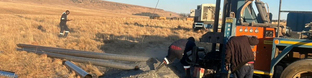
Groundwater Development and Management of Nzunguni Aquifer
Background
Nzuguni Ward, located in Dodoma City about 453 km west of Dar es Salaam, lies within a semi-arid zone that receives between 395 and 780 mm of rainfall annually, with temperatures ranging from 17.6°C to 29.6°C. The area is underlain by Precambrian Basement Complex rocks, mainly granites and older Dodoman formations, overlain by alluvial and residual deposits that influence groundwater occurrence.
Water supply for Dodoma City depends primarily on groundwater sources. The main source is the Makutopora Wellfield, located about 25 km from the city along the Arusha Road, which currently produces approximately 62,000 m³/day. However, with the relocation of the national government to Dodoma, the city’s water demand has increased significantly, bringing existing sources close to their limits. To meet the rising demand, the government has been exploring additional groundwater potential around Dodoma and has also commissioned studies for bulk water transfer from Mtera Dam (about 140 km away) and the construction of new storage at Farkwa (116 km from the city).
A recent study by the Ministry of Water identified the Nzuguni area as one of the promising groundwater development zones. The Dodoma Urban Water Supply and Sanitation Authority (DUWASA) has since drilled three production wells in the Nzuguni Aquifer, each with a yield exceeding 70 m³/hr. However, the aquifer lies close to human settlements, posing a risk of contamination, particularly from nitrates. Understanding groundwater recharge dynamics, water level fluctuations, and water quality variations is therefore crucial for ensuring sustainable use and protection of this resource.
To strengthen groundwater management, the Ministry of Water implemented the Nzuguni Groundwater Monitoring and Development Project through the Wami Ruvu Basin Water Board, with financial support from SADC-GMI and the World Bank. The project involved drilling two groundwater monitoring boreholes and one production borehole to:
- Monitor groundwater levels in the Nzuguni Aquifer to inform sustainable abstraction strategies, particularly for DUWASA’s public water supply scheme; and
- Provide a reliable water supply to the Buigiri School of the Blind through the installation of a production borehole and submersible pump system.
Project objective
The project objective was to enhance sustainable groundwater management. The study aimed to;
- Determine the spatial extent and recharge mechanisms of the aquifer.
- Locate and drill two monitoring boreholes and one production well.
- Install equipment for groundwater abstraction and monitoring.
- Generate baseline data to support groundwater monitoring and long-term aquifer management.
Project Progress
The project was completed in June 2025 using an integrated approach that combined environmental and social safeguards, hydrogeological and geophysical investigations, borehole drilling and testing, and the installation of monitoring loggers and pumps.
Project Achievement
Key activities included:
- Hydrogeological and Geophysical Survey: Conducted desk studies and field investigations (VES, profiling, and calibration with known boreholes), leading to the identification of suitable drilling sites.
- Aquifer Recharge Assessment: Reviewed literature and compared with nearby aquifers (Makutopora, Chamwino) to identify recharge sources and recommend long-term monitoring methods.
- Drilling and Testing: Drilled three boreholes (two monitoring, one production), performed 48-hour pumping tests, and analyzed water quality, yield, and drawdown data.
- Pump Installation: Installed a Pedrollo 4SR 2/23 submersible pump at 167 m depth, including accessories, HDPE pipelines, and a 5,000 L storage tank with an automatic refill system.
- Monitoring Equipment: Installed and commissioned two stainless-steel groundwater loggers with secure protective chambers.
ESMP Documentation: Download
Groundwater Investigation of seven villages within Rufiji sub catchment for potential augmenting Dodoma Water Supply
Background
Dodoma, the capital city of Tanzania since 1974, is increasingly experiencing water supply challenges driven by rapid population growth following the relocation of the Government seat from Dar es Salaam. Located in a semi-arid region with no perennial rivers in its vicinity, Dodoma City depends almost entirely on groundwater resources for domestic, industrial, and economic water supply. According to the 2022 National Census, the city’s population is approximately 792,511 and is projected to grow significantly in the coming years, with an estimated annual growth rate of about 6.1%. This rapid urban expansion is placing increasing pressure on existing water supply systems and groundwater resources.
To ensure a reliable and sustainable water supply that meets modern standards, the Ministry of Water (MoW) of the Government of Tanzania has been exploring a range of medium- to long-term water supply options. These include the proposed Farkwa Dam on the Bubu River, located approximately 130 km north of Dodoma, enhancement of yields from the Makutupora wellfields, and potential water transfer schemes from Lake Victoria. In addition, the Government is promoting water security through enhanced natural storage and managed aquifer recharge (MAR) at the Makutupora wellfields, which offer innovative short- to medium-term solutions for meeting the city’s bulk water supply demands.
The Makutupora wellfields are characterised by fault-controlled aquifer systems with dense fracture networks that support high groundwater yields. While similar hydrogeological structures are expected to exist in the wider Dodoma region, limited exploration has been undertaken to identify additional productive aquifers. Recognising this gap, the Government has initiated groundwater exploration activities around Dodoma City to identify supplementary aquifer systems capable of augmenting the city’s water supply. These efforts include geophysical investigations and the drilling of exploratory and monitoring boreholes, which have indicated promising groundwater potential in the study area.
Given these findings, the Government of Tanzania intends to utilise SADC Groundwater Management Institute (GMI) funds to complement ongoing national initiatives aimed at developing additional wellfields to enhance water supply for Dodoma City and surrounding villages. Strengthening groundwater resource assessment, monitoring, and sustainable development is therefore critical to improving water security, supporting urban and peri-urban growth, and enhancing resilience to climate variability in the Dodoma region.
Objectives
The overall objective of the project is to enhance water security for Dodoma City and surrounding communities through the identification, development, and sustainable management of groundwater resources.
Specific Objectives
- To identify and characterise additional groundwater aquifer systems in and around Dodoma City through integrated hydrogeological and geophysical investigations.
- To assess groundwater availability, yields, and sustainability to support the development of new wellfields that can augment existing water supply systems.
- To drill, equip, and monitor exploratory and production boreholes to confirm groundwater potential and inform future groundwater development.
- To strengthen groundwater monitoring and data collection to support informed planning, decision-making, and long-term water resource management.
- To complement ongoing national water supply initiatives through regional cooperation and technical support under the SADC GMI framework.
Project progress
Project is in its final stages of implementation
Project achievements
Groundwater investigation studies and site identification were successfully completed. Subsequently, two monitoring boreholes and one production borehole were drilled. Data loggers were installed in the monitoring boreholes, and rain gauges were established to support continuous monitoring.
ESMP Documentation: Download
Groundwater Mapping and Development at Sihumbwa Basic School in Kazungula District Southern Province – Zambia
Background
Sihumbwa Basic School, located in Kazungula District of Southern Province, was established in 1943 and has steadily expanded over the years. The school is earmarked for upgrading to a secondary school, yet it faces persistent water shortages that affect both the school and the surrounding community.
The school serves approximately 500 pupils, while about 2,500 community members depend on a single low-yielding and unreliable borehole that often dries up during the dry season. As a result, pupils and community members are forced to walk nearly 7 km to Ngwezi River to fetch water, reducing learning time and affecting health and sanitation.
The school operates a feeding programme aimed at improving nutrition, attendance, and academic performance. However, insufficient water has led to the failure of the school garden, orchard, and a previously initiated goat project. Planned initiatives such as fish farming are also constrained by limited water availability. The water shortage further undermines community livelihoods, contributes to high poverty levels, increases water-related health risks, and negatively affects school retention, particularly for the girl child.
In response to limited livelihood opportunities, some community members have resorted to charcoal burning, leading to deforestation and environmental degradation. There is therefore an urgent need to explore and develop sustainable groundwater resources to improve water access for education, health, livelihoods, and environmental protection in Sihumbwa and surrounding areas.
Project objectives
Overall Objective
To undertake groundwater mapping and development in the Sihumbwa area of Kazungula District to improve access to reliable and sustainable water supply for the school and surrounding community.
Specific Objectives
- To identify, map, and characterize aquifers in the Sihumbwa area with adequate and sustainable groundwater potential.
- To assess and quantify the current and projected water demand for Sihumbwa Basic School and the surrounding community.
- To drill, construct, and develop three (3) productive boreholes for water supply.
- To design and implement a solar-powered water supply system to distribute water to the school and the surrounding community.
Project progress
All components of the project were carried out successfully, resulting in the full completion of planned activities.
Project achievements
- A detailed geophysical survey was conducted.
- Three (3) production boreholes were successfully drilled and equipped.
- A water reticulation network was constructed at Sihumbwa Basic School, providing water taps for teachers’ houses and ten (10) taps within the school.
- Water kiosks were constructed in Muzumi and Sihumbwa villages.
ESMP Documentation: Download
Zambia Labor Management Procedure: Download
Zambia Stakeholder Engagement Plan: Download
Chiparamba Aquifer Mapping and Wellfield Development Subgrant Project in Zambia, Chiparamba, Kasenengwa District, Eastern Province.
Background
Chiparamba is a sub-centre located in the Kasenengwa District of Eastern Province, where communities have long experienced challenges related to limited access to reliable and safe water supply. The area faces persistent water constraints, including seasonal shortages, inadequate water supply infrastructure, increasing water demand due to population growth, and pressure on existing groundwater resources. These challenges have negatively affected household water security, agricultural activities, and overall socio-economic development.
In response to these challenges, the Ministry of Water Development and Sanitation, through the Department of Water Resources Development, is implementing the Chiparamba Aquifer Mapping and Wellfield Development Project. The project seeks to assess groundwater potential, identify sustainable water sources, and strengthen water supply systems to improve access to safe and reliable water for the local population. The initiative is funded by the SADC Groundwater Management Institute (SADC-GMI) with support from the World Bank, reflecting a coordinated effort to promote sustainable groundwater management and enhance water security in the area.
Project objectivesThe main objective of the project is to undertake aquifer mapping and wellfield development in Chiparamba to improve sustainable water supply and strengthen groundwater resource management.
Specific Objectives
- To identify and characterise aquifers in Chiparamba in order to determine areas with sufficient productive capacity for sustainable water supply.
- To develop at least one wellfield to provide settlement-level water supply and support the growing population in Kasenengwa District.
- To undertake buffering and afforestation of the identified wellfield at Chiparamba Sub Centre.
- To protect the zoned wellfield through fencing.
- To sensitise the community on sustainable water resource management through afforestation initiatives and sustainable agricultural practices.
Project progress
The project is currently in its final stages of implementation, with most planned activities successfully completed.
Project achievements
A comprehensive hydro-geophysical survey was successfully conducted, resulting in the successful drilling and pump testing of nine boreholes. Of these, three boreholes will be utilised for production and integrated into the existing water supply network serving Chiparamba Sub Centre, while six boreholes will be designated for groundwater monitoring purposes. In addition, a reticulation system design has been developed to convey water from the wellfield to the sub-centre.
Zambia Project Manager: Rollet Jani / rolletjani@gmail.com
Environment and Social Management Specialist: Emma Ndhlovu / Senior Water Officer, Zambezi Basin Unit / emmandhlovu4@gmail.com
SADC-GMI Project Manager: Eng. James Sauramba, jamess@sadc-gmi.org
ESMP Documentation: Download ESMP_Zambia_Chiparamba
Zanzibar
Background
Zanzibar is an archipelago comprising several islands, with the main islands being Pemba and Unguja. Groundwater serves as the primary source of freshwater for domestic, agricultural, and socio-economic activities across the islands. However, increasing pressure on water resources has resulted in significant challenges, including overexploitation of local groundwater reserves and pollution arising from intensified anthropogenic activities.
The Zanzibar Water Policy recognises a number of institutional and operational constraints affecting effective water resources management. These include inadequate technical and institutional capacity to coordinate and deliver services in the water sector, ineffective monitoring of surface and groundwater resources, and limited assessment of climatic conditions. These limitations hinder the government’s ability to make informed decisions regarding the conservation, protection, and allocation of available water resources. Furthermore, insufficient capacity to implement conservation and protection measures has contributed to the encroachment of catchment areas, pollution of water sources, uncontrolled water abstraction, and the gradual depletion of freshwater resources. The water supply system in Zanzibar is largely sustained through continuous groundwater pumping, which further increases pressure on already stressed aquifers.
In response to these challenges, a potential subgrant project has been proposed to strengthen groundwater management and improve the national knowledge base on water resources. The project aims to enhance the capacity of the Ministry of Water, Energy and Minerals to effectively manage groundwater resources, strengthen knowledge management and capacity-building processes within the water sector, and improve the groundwater monitoring network across Zanzibar. These interventions are intended to support sustainable water resource management and improve long-term water security in the archipelago.
Project objectives
The project aims to enhance the institutional and technical capacity of the Ministry of Water, Energy and Minerals to effectively and sustainably manage water resources in Zanzibar.
Specific objectives
- Improve understanding of the national state of groundwater resources knowledge in Zanzibar
- Strengthen the technical capacity of the water sector to effectively develop and manage groundwater datasets and information.
- Build the National Institutional and Individual Skills for Groundwater Management in Zanzibar.
Project progress
the project is nearing completion, with most planned activities successfully delivered.
Project achievements
Through the project, several key activities have been successfully implemented in Zanzibar to strengthen groundwater management and institutional capacity within the Ministry of Water, Energy and Minerals.
- A comprehensive quantitative and qualitative assessment of groundwater resources was conducted.
- The existing groundwater monitoring network was mapped and evaluated.
- A native cloud-based GIS system for groundwater data management was developed.
- A digital repository and website for the Ministry of Water, Energy and Minerals were established.
- A national capacity needs assessment for groundwater management was carried out.
- A National Focal Group for Zanzibar was established and trained.
- Several capacity-building workshops were conducted for Ministry staff and key stakeholders, with one final training session remaining outstanding.
Groundwater Monitoring in the Save Alluvial Aquifer of Zimbabwe
Background
The Sabi Valley alluvium is the largest alluvial aquifer in Zimbabwe, estimated to hold about 1.6 × 10⁷ m³ of groundwater (Hindson and Wurzel, 1963). It is located in the Middle Sabi area of the Save Valley, with its well-field, comprising roughly 172 boreholes, stretching along the Save River between Birchnough Bridge and Chisumbanje. Boreholes drilled in the alluvial deposits typically range from 20 to 70 meters in depth and yield between 100 and 5,000 cubic meters per day.
Groundwater is the cornerstone of agricultural production in the Middle Sabi, supplementing water releases from Osborne Dam to irrigate over 150,000 hectares. However, agriculture, like other economic activities, can have adverse effects on groundwater resources, leading to depletion, deterioration in quality, and risks such as saltwater intrusion or salinization in specific contexts. Moreover, leaching from cultivated fields often introduces agrochemicals into recharge waters, further threatening water quality.
Given these risks, both qualitative and quantitative monitoring of groundwater in agriculturally intensive regions is critical for sustainable resource management and safeguarding public health. In Zimbabwe, the Save Alluvial Aquifer has historically been monitored by the Zimbabwe National Water Authority (ZINWA). However, monitoring efforts have faced significant challenges over the years. The current system is outdated, with limited capacity to track groundwater quality or abstraction rates. Additional setbacks include financial constraints, reduced institutional capacity, vandalism of equipment, and deteriorating infrastructure.
As a result, unsustainable groundwater use is increasingly evident in the region, raising concerns for the Save Aquifer as well. To address these challenges, it is essential to modernize the monitoring systems in the Save Alluvial Aquifer to ensure the collection of reliable, qualitative, and quantitative data, enabling effective groundwater management and optimization.
Project Objective
The primary objective of the project is to modernize groundwater monitoring in the Save Alluvial Aquifer by implementing a real-time telemetric system. In addition, the project incorporated the solarization of a community borehole as part of corporate social responsibility efforts to improve access to a safe water supply.
Project Progress
The project was completed in July 2025
Project achievement
The following are key achievements from the project:
- Design of a new groundwater monitoring network for the Save Alluvial Aquifer
- Installation and configuration of nine data loggers with telemetry units
- Training on the installation, configuration, operation, and maintenance of data loggers and telemetry units
- Solarization of a community borehole.
ESMP Documentation: Download
Siyakobvu Water Project
Background
Mashonaland West Province is semi‑arid, receiving average annual rainfall of 450–650 mm and experiencing periodic seasonal droughts and severe dry spells. Groundwater, therefore, provides a critical buffer against climate variability and short‑term droughts. However, water quality is frequently compromised by both geogenic and anthropogenic factors: elevated fluoride concentrations arise naturally from fluoride‑bearing geology and are exacerbated by poor solid‑waste management and the discharge of fluoride‑rich agrochemicals. High fluoride levels have caused widespread health problems, notably dental and skeletal fluorosis, and have contributed to the deterioration of borehole infrastructure. To address these issues, the Department of Water Resources Development and Utilization, the Department of Water, Sanitation and Hygiene, and Chinhoyi University of Technology intend to collaborate on interventions to improve water quality and access in Siyakobvu.
Kariba Rural District (Mashonaland West Province) is experiencing a severe water shortage driven by groundwater depletion and declining water quality. Depletion is exacerbated by drought, irregular aquifer recharge, and the seasonality of most wells, which frequently run dry during dry spells. Water-quality deterioration reflects both natural geology, particularly fluoride-bearing formations, and anthropogenic factors such as poor agricultural practices; elevated fluoride levels have led to widespread dental and skeletal fluorosis. To address these challenges, the Department of Water Resources, the Department of Water, Sanitation and Hygiene (WASH), and Chinhoyi University of Technology propose a multisectoral hybrid project with two complementary components: (1) groundwater-quality research to develop targeted mitigation technologies and management strategies, and (2) interventions to increase the supply of safe potable water, thereby improving public health and livelihoods.
Project objective
The project aims to undertake a comprehensive groundwater-quality assessment in the Siyakobvu area of Kariba District to characterize aquifer conditions, contamination sources, and spatial–temporal variability. Based on these findings, it will develop sustainable management strategies and context-appropriate, innovative technologies to mitigate groundwater contamination and strengthen local water security. Finally, informed by the hydrogeochemical characteristics and identified contamination pathways, the project will design and implement suitable water‑treatment solutions to deliver safe potable water and improve public health outcomes in the community.
Project progress
The Project is in it’s early stages of implementation
Project achievements
- Water samples were collected in the Siyakobvu Area and successfully analysed and characterised.
- Stakeholder engagement activities were undertaken.
- A feasibility study assessing the long-term sustainability of Negande Spring in Siyakobvu was successfully completed.
ESMP Documentation: Download